GPS Receiver
GPS module receivers are generally used in smartphones, fleet management systems, military, etc. for tracking or finding a location.
Global Positioning System (GPS) is a satellite-based system that uses satellites and ground stations to measure and compute its position on Earth.
GPS is also call as Navigation System with Time and Ranging (NAVSTAR) GPS.
GPS receiver gives output in standard (National Marine Electronics Association) NMEA string format. It provides output serially on the TX pin with default 9600 Baud rate.
This NMEA string output from the GPS receiver contains different parameters like longitude, latitude, altitude, time, etc. which are separates by commas. Each string starts with ‘$’ and ends with a carriage return/line feed sequence. For e.g
$GPGGA, 184241.000, 1829.9639,N, 07347.6174, E, 1, 05, 2.1, 607.1, M,-64.7, M, ,0000*7C
Related Articles:
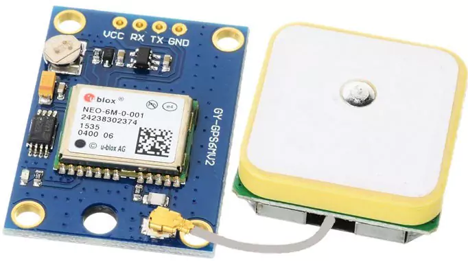
Pin Description of GPS Module
- VCC: Power Supply 3.3 – 6 V
- GND: Ground
- TX: Transmit data serially which gives information about location, time, etc.
- RX: Receive Data serially. It is requires when we want to configure the GPS receiver.
GPS Module Specification
- The GPS chipset is Media Tek MT 3318, 51 Channel.
- Frequency is L1, 1575.42 MHz; C/A Code.
- Protocol: NMEA 0183 v3.01, MTK NMEA Compound.
- UART interface.
- Baud Rate of 9600bps (default).
- Working Temperature: -40 °C to 85 °C.
Check GPS Receiver Module
After connection GPS receiver opens any serial monitor at 9600 baud rate. The terminal will show data coming from the GPS receiver.
E.g. $GPGGA, 184241.000, 1829.9639,N, 07347.6174, E, 1, 05, 2.1, 607.1, M,-64.7, M, ,0000*7C
In the above string, the NMEA string starting with “$GPGGA” is most common in use. It provides us Time, Longitude, Latitude, and Altitude along with directions. This information is helpful to find Time and Location.
| Name | Example | Units | Description |
|---|---|---|---|
| Message ID | $GPGGA | GGA Protocol Header | |
| UTC Time | 184241.000 | hhmmss.sss | |
| Latitude | 1829.9639 | ddmm.mmmm | |
| N/S Indicator | N | N=North, S=South | |
| Longitude | 07347.6174 | dddmm.mmmm | |
| E/W Indicator | E | E=East, W=West | |
| Position Fix Indicator | 1 | Fix GPS SPS mode | |
| Satellites Used | 05 | Range 0 to 12 | |
| HDOP | 2.1 | Horizontal Dilution of Precision | |
| MSL Altitude | 607.1 | Meters | Mean Sea Level |
| Units | M | Meters | |
| Geoid Separation | 64.7 | Meters | |
| Units | M | Meters | |
| Age of Diff. Corr. | – | Null field if DGPS is not used | |
| Diff. Ref Station ID | 0000 | ||
| Checksum | *7C | ||
| Carriage return Line Feed | <CR><LF> | End of message transmission |
Common Applications of GPS Receiver Modules
GPS receiver modules have become ubiquitous in various industries due to their versatility and precision.
- One common application is in the automotive sector, where GPS modules are used for navigation systems, vehicle tracking, and fleet management. This technology enables drivers to access real-time traffic information, optimize routes, and enhance overall driving efficiency.
- In the aviation industry, GPS receiver modules play a crucial role in ensuring accurate aircraft positioning and navigation during flights. They help pilots maintain precise course trajectories, improve safety measures, and streamline air traffic control operations.
- Additionally, these modules are utilized in unmanned aerial vehicles (UAVs) for autonomous flight missions and surveillance activities.
- Furthermore, GPS receiver modules find applications in marine navigation systems for ships and boats.